Traditional Survey Costs vs Drone Technology - The 2025 Yorkshire Reality Check
Why Yorkshire Contractors Are Abandoning Traditional Surveys
Picture this: Monday morning, 9:15am. Mark opens two survey quotes for his Wakefield development site.
Traditional topographical survey: multi-day timeline, weather-dependent scheduling, standard 2D deliverables.
Drone survey: same-day completion, comprehensive 3D models, weather-flexible operation.
The difference isn't just methodology. It's everything that methodology represents.
But here's the myth that's costing Yorkshire businesses thousands:
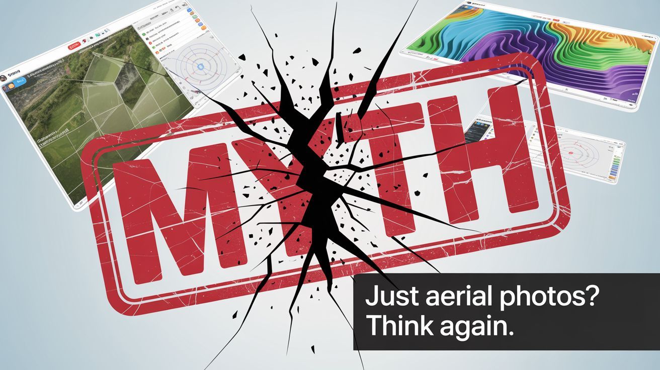
"Drone surveys are just aerial photos, you get what you pay for."
Time to destroy that misconception.
The Myth Everyone Believes
"Traditional surveys are more accurate. Drones are fine for marketing shots, but serious construction needs proper surveying." Sound familiar?
Every construction manager in Yorkshire has heard this. Many still believe it.
Here's what that belief actually costs: extended project timelines, weather delays, incomplete data sets, and significantly higher overall project costs for often inferior results.
The Hidden Truth About Survey Accuracy
Traditional Assumption: Ground-based total stations provide superior accuracy.
Reality Check: Modern drone photogrammetry delivers 2-3cm accuracy across entire sites. That's not "close enough" that's precision surveying that meets or exceeds most construction requirements.
But accuracy isn't just about millimetres. It's about comprehensive coverage.
Traditional Survey Coverage Picture a surveyor with a total station. Measures specific points across the site. Connects these points to create a model. Misses what happens between measurement points.
Result: accurate points, but incomplete understanding of site conditions.
Drone Survey Coverage Imagine capturing every square centimetre of your site in a single survey. Not just spot measurements - complete, continuous data showing every contour, every feature, every potential issue.
Result: comprehensive accuracy across 100% of your site.
The Real Cost Comparison
Industry data reveals significant differences between traditional and drone surveying approaches. According to UK surveying professionals, traditional topographical surveys typically cost £350-£1,200 per day for fieldwork, plus £350-£650 per day for office processing. Source
Traditional Survey Approach:
- Multi-day site presence required
- Weather delays typically add 3-5 days
- Processing takes 3-5 additional days
- Deliverables: 2D plans, spot elevations
- Coverage: sample points across site
- Change detection: requires complete re-survey
Drone Survey Approach: Source
- Site survey: 2-3 hours flight time
- Weather flexibility: shorter windows sufficient
- Processing: same-day to 24 hours
- Deliverables: 2D/3D models, orthomosaics, point clouds
- Coverage: every centimetre captured
- Change detection: overlay comparisons show exact differences
The time difference alone represents substantial project savings, before considering reduced weather delays and enhanced data quality.
What Traditional Surveys Can't Tell You
Imagine discovering these issues during construction instead of the survey phase:
Drainage Problems: Traditional surveys measure spot elevations. Drone surveys reveal subtle drainage patterns across the entire site. The difference between expensive corrections and preventive design.
Vegetation Impact: Ground surveys often estimate tree coverage and terrain beneath. Drone surveys show exactly what's where, enabling precise planning for removal or preservation.
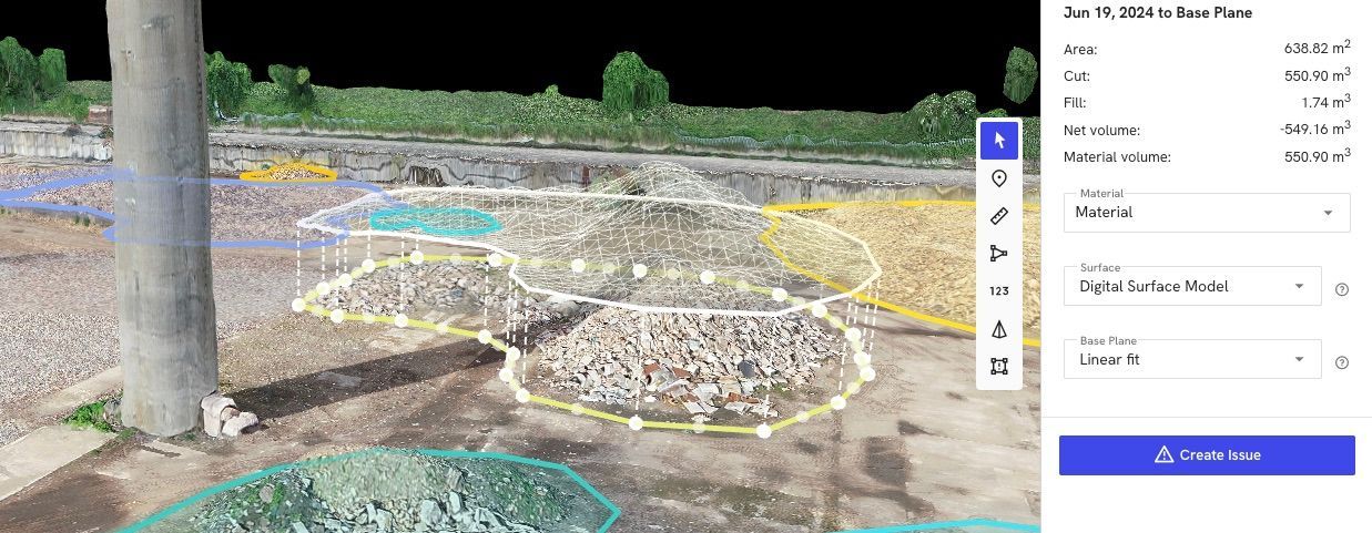
Stockpile Volumes: Traditional methods require physical measurement of material piles. Drones calculate exact volumes from 3D models. Critical for accurate project costing.
Access Issues: Traditional surveyors need physical access to every measurement point. Drones survey dangerous, unstable, or restricted areas safely and completely.
The Weather Window Reality
Yorkshire weather creates particular challenges for traditional surveying. Industry data shows weather delays commonly add 3-5 days to traditional survey schedules.
Traditional Survey Scenario Site team arrives Monday. Rain Tuesday and Wednesday. Equipment moved Thursday for partial work. Weekend delay. Resume Monday. Complete Wednesday. Processing begins Thursday.
Total timeline: 10+ days. Additional costs: extended site security, delayed project timeline, potential subcontractor rescheduling.
Drone Survey Scenario Weather window Thursday afternoon: 2-hour flight. Data processed Friday morning. Complete survey delivered Friday afternoon.
Total timeline: 2 days. Project continues on schedule.
The Data Quality Revolution
Traditional deliverables: CAD drawings showing survey points, elevations, and interpreted site features.
Drone deliverables: Everything traditional surveys provide, plus:
- Interactive 3D site models
- High-resolution orthomosaic imagery
- Detailed volume calculations
- Change detection capabilities
- Virtual site tours for remote stakeholders
Which would you rather present to investors, clients, or planning committees?
Yorkshire-Specific Advantages
Climate Reality: Yorkshire weather patterns favour drone surveys requiring shorter weather windows over traditional methods needing extended site access.
Terrain Challenges: From Yorkshire Dales topography to post-industrial sites, drones survey challenging terrain traditional methods struggle with.
Heritage Constraints: Many Yorkshire sites have archaeological or heritage sensitivities. Non-invasive drone surveys eliminate ground disturbance concerns.
Industry Cost Analysis
According to professional surveying data, drone surveys for topographical work typically range from £800-£1,800, while traditional approaches commonly cost around £500 per "man-day" plus extended timelines. Source
The real savings emerge from reduced project delays, weather-related extensions, and enhanced data quality enabling better decision-making throughout the construction process.
When Traditional Surveys Still Make Sense
Honesty matters.
Traditional surveys remain necessary for:
- Underground utility mapping
- Detailed structural assessments requiring physical contact
- Legal boundary disputes requiring precise ground markers
- Sites with strict no-fly restrictions
But for topographical surveys, progress monitoring, and volume calculations? Drone technology delivers superior results for comparable or reduced overall project costs.
The Strategic Business Decision
This isn't about technology for technology's sake. It's about competitive advantage through better data and faster decision-making.
Consider two competing contractors bidding the same project:
Contractor A: Uses traditional surveys, requires 10+ days for site analysis, bases bid on incomplete coverage, delivers standard documentation.
Contractor B: Uses drone surveys, completes comprehensive site analysis in 2 days, provides detailed 3D planning tools, offers ongoing progress monitoring.
Which contractor appears more capable, organised, and forward-thinking to clients?
The Implementation Reality
"This sounds expensive to implement."
Actually, no. You don't need to buy drones or hire specialists. Professional drone survey services provide all equipment, expertise, and processing capabilities. You access enterprise-level surveying technology without capital investment.
Overall project value matters more than individual service costs.
Making the Switch
Start with comparison: Request both traditional and drone quotes for your next site survey. Compare not just initial costs, but timeline, deliverables, and ongoing value.
Consider total project impact: Factor in weather delays, data quality improvements, stakeholder communication benefits, and ongoing monitoring capabilities.
Plan strategically: As government infrastructure spending accelerates through Yorkshire, comprehensive site data becomes competitive necessity, not luxury.
The question isn't whether drone surveys work - industry data proves their effectiveness. It's whether you'll adopt proven surveying technology before or after your competitors gain the advantage.
Ready to compare surveying approaches for your Yorkshire project?
Call Dee4Drones for detailed analysis of traditional vs drone survey options based on your specific requirements.